
Friday, 27 Sep 2019: Crossing the Cook Strait

On the Interislander ferry from Wellington to Picton, if you have the time, I strongly suggest that you enjoy this journey over flying. We were so lucky to get beautiful weather this day.

From the water, one really gets a sense for the beautiful complexity of the coast around Wellington, and just how good of a natural harbor the city is situated on.

A view of the North Island coast

I was very excited when the South Island came into view; this is a look from the North Island in the foreground across the Cook Strait to the South Island in the distance.

The Marlborough Sounds and the South Island

The coast along the Marlborough Sounds showcases some crystal clear waters along rugged, rocky, and forested shorelines. On such a clear day, it was simply spectacular.

The golden sands that I've been waiting so long to see again. Something about the northern coast of the South Island brings a golden yellow color to the sand that accumulates along the shore. Against the deep green of the forested hills, deep marine-turquoise of the sea, and crisp blues of the sky, the gold makes for truly tranquil and idyllic scenery.

Once ashore on the South Island, we took the long route to our destination via the super-scenic Queen Charlotte Drive. The road is narrow, winding, and steep, but it rewards with views like this and the next few pictures. That is, it's entirely worth the effort on a beautiful day like we were so lucky to get.


Wildfire strikes in real time. We stopped for a short walk to a viewpoint along the Governor's Bay Track. From the first view, we saw this plume of smoke growing in scale and billowing into the calm skies. It was a dark omen, clearly a wildfire that had just started to rage out of control. We heard later about it on the radio... it took several days to contain and devastated a large area. I wonder if it resulted from human activity... I would imagine so based on my experience from wildfires in California.

Back on the road along the drive to Nelson. The road passed through plenty of logging territory... looks like it isn't just the North Island's farm-forests that are being razed over and over again for the global demands for wood. Despite being largely tree plantations, the scenery was still quite lovely.

After a very long day of travel, we finally reached our destination: Marahau and the gateway to Abel Tasman National Park. We stayed at The Barn, which I was very happy to see is still there (see my 2006 post from this area) and doing very well.

Before sunset, we took a short hike into the park. These are the wetlands and tidal flats at the park entrance.

With such large tidal flats along the coast here, the tide comes in very, very quickly. We could watch the water reclaiming the land, with acres disappearing under in just seconds.

The granite boulders, characteristic of the Abel Tasman coast.

Sunset over Fisherman Island.

The mountains of the South Island call to us at sunset, promising that we are in for a beautiful and remote few weeks on the South Island. That night, we were also treated to another epic Southern starry sky. I love New Zealand.
Saturday, 28 Sep 2019: Abel Tasman National Park

This was a day that I had been waiting years and years (13 to be exact) to have: sea kayaking in Abel Tasman National Park.

We got nice weather... not perfect thanks to a high, light cloud that ensured that we stayed in shade (thus never revealing the gin-clear, turquoise-tinted waters that the national park is so famous for), but still pleasant nonetheless. With the cloud cover as it was and practically no wind, the early morning sea was glassy smooth with a mercury-like sheen.

Abel Tasman National Park is a coastal park, characterized by lush, densely forested hills and granite strewn coastline disrupted here and there by golden sand beaches. It is beautiful... my kind of paradise.


The day was so nice that we were graced with this view of the snow-capped peaks of Nelson Lakes National Park, which I can assure you is quite a distance from Abel Tasman. We were lucky to get this view, and I was so excited to be seeing such rugged peaks and so much snow from the luxury of a beautiful beach.

The park is home to several colonies of fur seals. The colonies seem to be quite healthy, and the many pups we saw were adorable and quite playful.


We were also treated to a sampling of the various bird species of New Zealand. Before humans arrived, Aotearoa was the Land of the Birds, with the only land-based mammals present being a native species of bat! There were many, many native species of birds though, which had evolved as the dominant species on the islands since they had split from Gondwana approximately 85 million years ago. The bird above is a pukeko (which elsewhere is known as an Australasian swamphen). These birds have adapted well to pastureland, while their natural territory is swamps and grassy wetlands. Each morning at The Barn (our accommodation at Abel Tasman), we woke to many of the colorful creatures foraging around our camp.
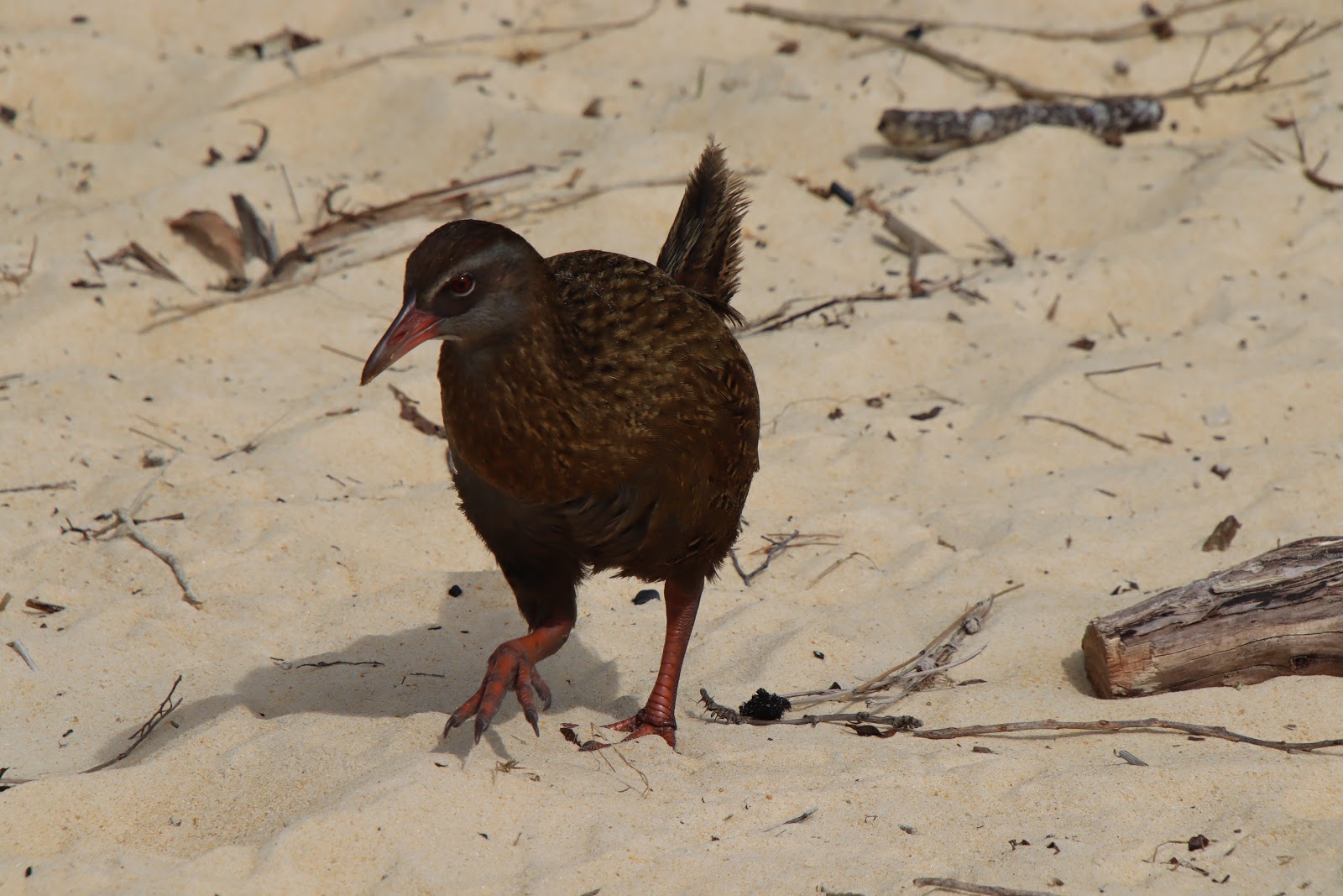
The weka is a bird that many tourists mistake for New Zealand's famous kiwi, mostly because of their color and flightless nature. They are furious foragers and can be quite cheeky. Later in the day, we had a curious weka hanging around us as we enjoyed our post-kayak meal of burgers and fries. We were amusingly surprised by the speed at which the bird lunged for a fry that fell off our table. The weka claimed its prize and disappeared before we had any real chance to react... it was impressive!

On the beach, we enjoyed watching (and listening to) a pair of torea-pango (known as the variable oystercatcher in English). These birds had a distinct call, which they seemed to use to indicate a threat since they only made the noise as we walked past and were clearly irritated by our presence. We tended to see these birds only in pairs.

Some pārekareka, or spotted shag. We saw several colonies of these seabirds during our kayak trip.

As the tide receded, a natural spring was revealed along the shoreline; the freshwater pouring through the sand left this amazing fractal pattern of grooves and channels in the wet sand.

We finished the day at Anchorage, where we were able to enjoy some strolling on the beach and exploring of the caves, sea arches, and hiking trails around the area before we were picked up for our water taxi ride back to Marahau.
Sunday, 29 Sep 2019: Drive to the West Coast

A gloomy day over Lake Rotoiti in Nelson Lakes National Park. We stopped here for a quick hike through the forest along the lake shore and some views of the lake and mountains. Despite the weather, it was still lovely.


More birds, though these ones weren't native to New Zealand. Black swans were introduced from Australia in the mid-nineteenth century.

The drive from Abel Tasman to the West Coast was beautiful, despite the wet weather.

The road to the West Coast follows the Buller River Gorge. An industrious family with land along the river has built this Indiana-Jones-style swing bridge and zipline across the river. Crossing the bridge is a hair-raising experience, especially on very slippery, rain-soaked metal grating and views right through it to the raging and swollen river below.

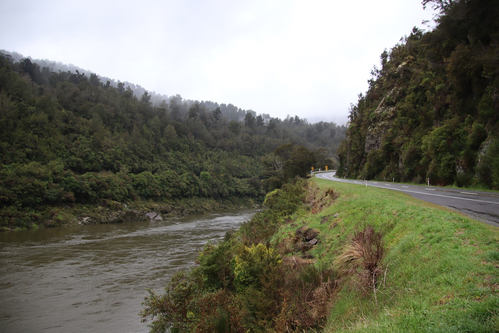
Further downstream, the river grows significantly and quite noticeably.

We stayed near Westport, which is one of the bigger towns along the South Island's remote and isolated West Coast. The town boasts excellent surfing and a seal colony nearby. We had a good, long day of driving, but after all the rain, it was nice to tuck up into our eco-lodge under a blanket and enjoy some reading by the fire.
Monday, 30 Sep 2019: Westport to Franz Josef Glacier

Our first stop for the day was the Punakaiki Pancake Rocks. These baffling geological features consist of layered, limestone rocks, though geologists struggle to explain how exactly the layers were originally formed.

There seems little doubt that the layers were formed by some kind of regular, periodic source, perhaps ebbing and flowing with the amount of life in the sea over which the sediments were first laid down (limestone forms from the remnants of ancient life, such as coral and mollusks).

The pancake rocks exist along a stretch of treacherous coast, with steep, ragged cliffs battered by strong surf. Due to the complexity of the pockmarked shoreline there, there are also several blowhole vents (like the one pictured here) and sea caves around the area.

We had a rainy morning, which is typical weather along the South Island's rugged West Coast.

I got plenty of more experience with New Zealand's infamous one-lane bridges along the drive too.


We arrived at Franz Josef Glacier in the late afternoon, but when we got there, the view did not look like this. When we arrived, the whole valley was full of low-lying cloud and mist. However, this gives a view of the current extent of the glacier for comparison with the next two pictures.

These signs were posted along the way; a devastating reminder of how rapidly glacier melt is accelerating in many places

I was at Franz Josef Glacier last in 2006, and we spent a lot of our approach walking over rock that was covered in 10s of meters of ice the last time I'd seen the glacier. Climate change is real, and so much of the world's ice is melting at a terrifying rate.

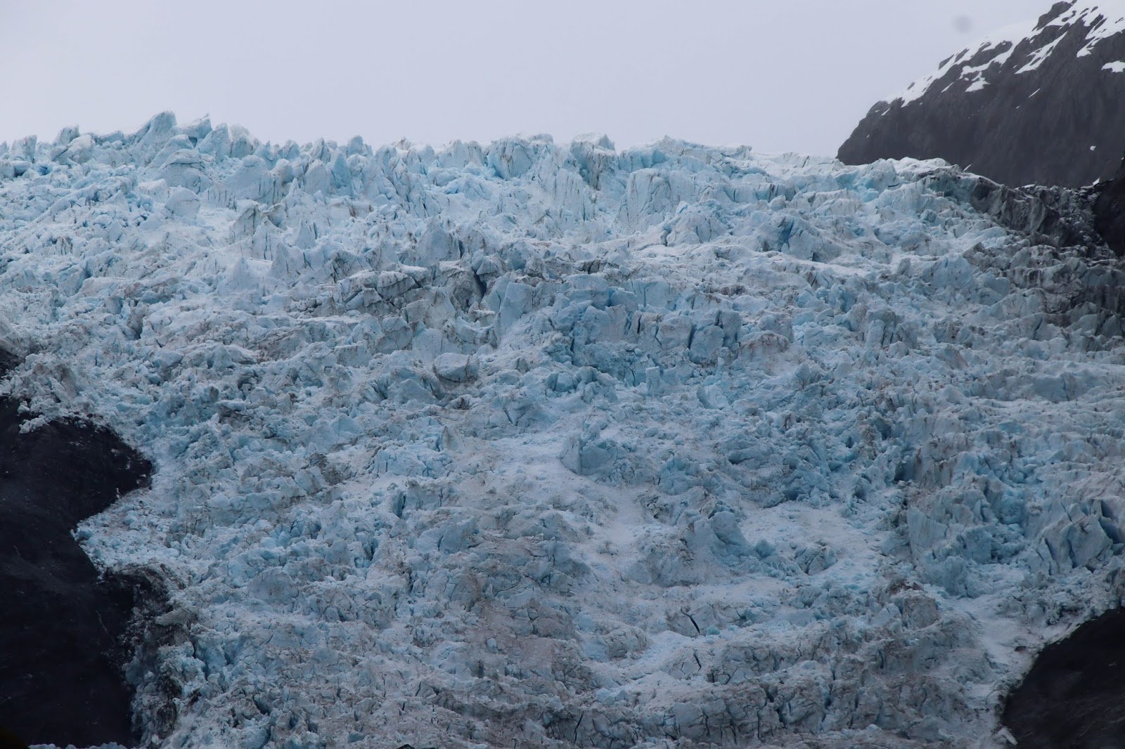
This is what the glacier looked like when we first approached it. The picture is difficult (impossible) to gauge scale with; the ice that comprises the glacier is up to 300 m (~1000 feet) thick. Those chunks and boulders that you see in the following pictures are the size of large buildings...

We got very, very lucky: the clouds slowly but surely lifted off the glacier, revealing more and more and more of its incomprehensibly massive grandeur

The light played over the craggy, imposing surface of the glacier in the most beautiful ways. We truly got a show.

Once revealed, we realized that we'd just been looking at such a small part of the full behemoth. Even with this view, the majority of the glacier lies hidden as it continues further up the mountains.
Seeing those chaotic jumbles of house to apartment building sized pieces of ice, it is not difficult to comprehend how the rock that falls onto the surface and that lies underneath the ice is slowly but surely scraped, polished, and ground to a fine dust. Adventurers that go onto glaciers really are tempting death. Despite their static appearance, glaciers are dynamic structures, and their ice is ever cracking and shifting and crumbling.

The glacier scours the rock walls of the valley, easily peeling off layers of loose material to expose and carve away at solid rock beneath.

Over 10s of thousands to millions of years of grinding advance and retreat, the glacier carves out a distinct shape in its valley, leaving a trail of detritus and dust along the flattened floor. This shot is looking down the valley towards the sea.

The steep rock walls also make for some epic waterfalls originating from the higher terrain.

Looking back up the valley toward the glacier.

That night, we took a short night hike out of town to a stretch of trail that is graced with glow worms. The picture above is not the night sky; each of those little points of light is a little, predatory worm. The glow worms are the larval stage of a species of gnat, and the little blue lights are a form of bioluminescence. The light serves as bait for small flies that live along water ways. Below each light, the worms dangle a thread of sticky silk (like spiderweb), which they use to ensnare their prey. Once captured, prey is coiled up and the worm feasts by draining the fluids from the body of the victim, very much like a spider. For such vicious little creatures, they really are beautiful.
Tuesday, 1 Oct 2019: Franz Josef Glacier to Wanaka via Haast Pass

We woke up to crystal clear skies; it was going to be an epic day on New Zealand's West Coast.

Taking advantage of the perfect weather, the helicopters were flying one after another after another up to the glaciers.

After a quick breakfast at one of the not-so-good restaurants in Franz Josef (they all cater only to tourists... no demand for quality there!) we took an hour to scope out the West Coast Wildlife Centre, which has an excellent kiwi exhibit. At the time of our visit, the centre boasted a couple of rowi kiwi (Maori do not use plural words) in their rearing, rescue, and rehabilitation facility plus several tuatara lizards, which are essentially living dinosaurs. These were the only live kiwis we saw on our trip, so I'm very glad we took the time to do this, even considering the beautiful weather outside. For obvious reasons, we couldn't take pictures of the nocturnal birds in their dark enclosure, but we could get right up to the glass to enjoy close up views of the bizarre but beautifully unique animals.

Kiwi are endangered or vulnerable (depending on the species), and their habitat is now extremely limited compared to the former range of these incredible birds, largely due to deforestation (most of those beautiful green fields - grazing land for cattle and sheep - used to be forested land) and loss of habitat initially after European settlement and then the wave upon wave of introduced, invasive species that kill kiwi (either for food or sport) or eat their eggs. New Zealand is now taking drastic and controversial measures in several places around the country: using poisons to kill the invasive species (stouts, possums, rats, mice, etc.) that cause the most damage to kiwi population growth.

Next, we got outside to take advantage of the brilliant weather. We were treated to a spectacular set of sights at Lake Matheson, including some great views of the often-veiled-in-cloud pair of highest peaks in the country.

Aoraki, Mt. Cook

Horokoau, Mt. Tasman

Horokoau in all its spectacular glory. These pictures were taken from near sea level, but those two peaks rise up 3,497m (11,473ft; Horokoau) and 3,724m (12,218ft; Aoraki) above sea level. That kind of gradient makes these shots look as if they were taken from a plane at altitude. Simply put, they are spectacular in their grandeur.

The trail to Lake Matheson was also very pleasant.

Lake Matheson on a good day is a mirror lake... offering views like this from the perfectly named View-of-Views lookout point


We also got to see one of the lake's many eel residents. I really didn't know much about freshwater eels before this trip, but they are incredible animals. They can live up to 80 or 90 years old. They are born deep out at sea and travel thousands of miles to the continents, where they swim swim swim up waterways, deep inland, where they set up shop for the vast majority of their lives in some little water hole. When they are ready to die, they swim back out to sea again to spawn. It makes me feel a lot guiltier about enjoying these so much when I eat sushi and Japanese cuisine. Of course, with a life cycle like that, these animals cannot be farmed (people claim they are farming eels, when all they are doing is catching the babies - fingerlings - in the wild and then raising them in controlled environments; it is NOT sustainable because it robs the wild of literally millions of the next generation of young eels), so all eels are wild caught, but in the wild would possibly have lived longer than you will.

Speaking of waterways, in New Zealand, every waterway that roads pass over is named and marked (see yellow sign). This might not sound like much, but being there and seeing how often this occurs, it is incredible that they've gone to that much trouble to do this! Other than for navigation purposes, I cannot imagine what the motivating factor was in ensuring that each one is marked like that.

We stopped partway down the Southern West Coast to check for penguins at Munro Beach.

Sadly, there were no penguins...

We did see some nice examples of koru, the coiled shoot of a new fern

The drive was spectacular to say the least.

We crossed the Southern Alps via the Haast Pass, which snakes its way up alongside the Haast River (seen here) before crossing a deceptive high point and coming back down again between Lakes Wanaka and Hawea.


One of the high peaks viewed from the journey through Haast Pass.

There are also several waterfalls to check out along the way. These are just very short walks from parking points alongside the road.


Lake Wanaka

After an epic day of driving, we settled into our lovely little bed and breakfast in Wanaka and enjoyed a delicious dinner at a local pizza place.
Wednesday, 2 Oct 2019: Around Lake Wanaka

We started the day with a drive up the road around Glendhu Bay toward Mt. Aspiring.

As expected, we had some beautiful scenery along the way.

This bizarre tree and pond caught our attention. It sits in the middle of a cattle ranch.

Along the dirt road to Mt. Aspiring

Finding the road up to the Mt. Aspiring trailhead impassible in our little rental car, we instead opted to take a lovely stroll around Glendhu Bay.

The water in Glendhu Bay is impossibly blue.

Back on the road, we backtracked some of our route up toward Haast Pass to see some of the sights that we had to skip in the interest of time from the previous day.

We took a pleasant hike in Mount Aspiring National Park.

The swing bridges are well marked to indicate danger of overloading...

The Blue Pools are named for that brilliant gem-colored water.

Looking upstream: the source of that crystal clear water lies in glacial melt off of not-so-distant high peaks, some examples of which are shown below.


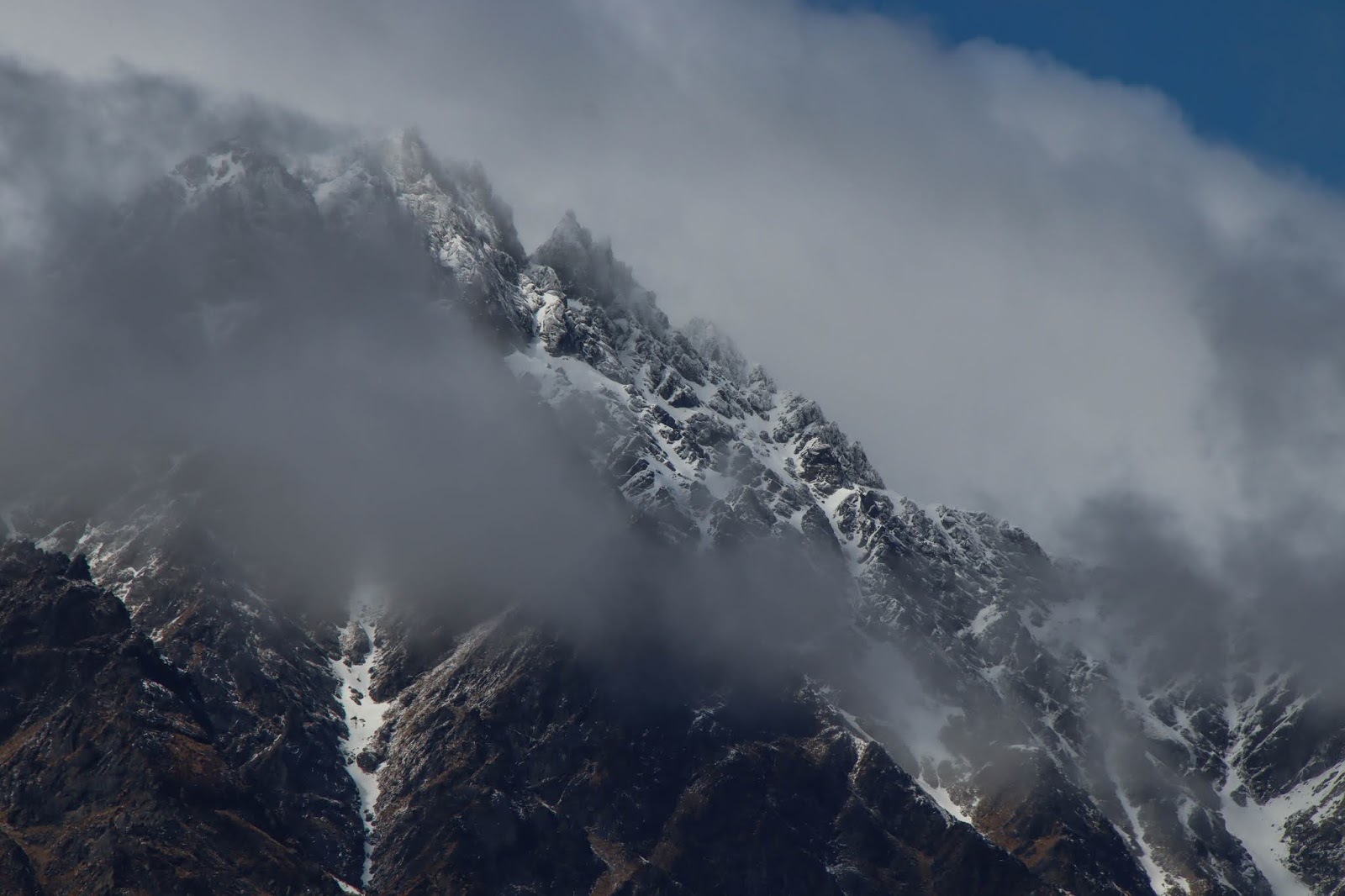
Many of the South Island's high peaks are still heavily glaciated.

Despite all the snow at higher elevations, the valleys and forests below are verdant and green. Though a wonder in themselves, it is no wonder that these mountains are named the Southern Alps.
We spent the evening enjoying some fantastic Indian food at The Spice Room in Wanaka, strolling around town, and sipping wine in our lovely little Bed & Breakfast.
Thursday, 3 Oct 2019: Wanaka to Glenorchy via Queenstown

On the drive from Wanaka to Queenstown... we took the shorter (distance) route through the mountains, which was quite rewarding thanks to views like this one.

Before leaving Wanaka, we had brunch at the delicious and super-friendly Federal Diner. On the walk back to the B&B, we were treated to a perfect view of Mt. Aspiring over Wanaka's Helwick Street.

More epic views from the mountain road connecting Wanaka and Queenstown. The snow-covered mountains on the left here are the backside (from Queenstown's perspective) of The Remarkables range.

The Remarkables are a range of mountains along the "feet" side of Lake Wakatipu with their most most-rugged side facing right towards Queenstown. We were treated to some great views both in daylight...

...and around sunset.

Being Spring, there was still plenty of snow up in the fractal pattern of couloirs in that seemingly impenetrable terrain.

Approaching Queenstown, I knew as soon as we had passed the road to the airport that things had changed drastically for the worse since I had visited for the first time in 2006. We got stuck in miserable traffic on the way into town... and all of the delays had to do with idiot tourists (to be quite honest, almost all of them were evidently Chinese tourists) who had no idea how to drive or walk without causing tremendous disruptions to the normal flow of traffic. It was infuriating and a sure sign of the horrors that were to greet us in Queenstown itself. The once beautiful town has been disfigured into a classic example of a tourist trap. The town has also seen explosive growth and ever-spreading urban sprawl of what appear to be mostly vacation homes and time-shares for the wealthy.

And this did it for me: a fucking haunted house. If anyone has heard me gripe about Niagara Falls and how it represents the very worst of how tourism can (and will?) ruin the world and even its most beautiful, spectacular natural places, you'll know why I was so devastated to see this hideous blight of a tourist trap prominently displayed and operating in Queenstown. That blue smoke (I simply desaturated all colors but blue and red in this picture... so for some reason, there really was a strong blue tint to the smoke there...) is pouring out of a "American-style" barbecue restaurant. Hideous.

The beautiful old Eichardt's Hotel alongside the jetty's for the noisy and polluting jet boat tours jetty. The spectacular Remarkables shoot up above town in the background. The town itself was inundated with tourists, mostly Chinese, which seem to have just completely overtaken parts of the South Island now. I fear that New Zealand is selling its soul for yuan.

What could be a picture from a bygone era if it weren't for that hideous and noisy parasailer and jet boat... the old steamer pictured here is the TSS Earnslaw, an Edwardian era relic from 1912 that still offers cruises around a portion of Lake Wakatipu. This ship is the only coal-fired steam ship offering passenger services remaining in the southern hemisphere.

Spring flowers in Queenstown Gardens

We were pleasantly surprised to find several giant sequoias growing around Queenstown, including the twin, 144-year-old Trees of Justice outside of the courthouse. Those Trees of Justice (not pictured here) were planted by a man who ended up standing under them after being sentenced to 5-years in prison for embezzlement. Justice, rightfully as blind and impartial as those trees, was served that day. The giant sequoia pictured above is in the beautiful Queenstown Gardens, which offer up a very pleasant and peaceful escape from the awful tourist traps around town.

Views across Lake Wakatipu from the Queenstown Gardens

The Remarkables in all their rugged glory

This tui, which quickly established itself as my favorite of New Zealand's native bird species, treated us to a spectacular show and concert from this kowhai (pronounce: "KO-fai") tree. Our luck in NZ continued: being springtime, the kowhai were in bloom, and the pollen in those bright yellow blossoms is a favorite food of many of NZ's bird species, especially the tui. This tui was clearly enjoying it (note the yellow pollen around his nostrils on the beak); he sang us some beautiful songs with those complex and otherworldly notes, clicks, beeps, and chirps that the tui are capable of producing.

These pictures revealed detail of the tui's colors that I had not appreciated trying to catch glimpses of the birds in motion. They really are spectacularly beautiful birds in every way.

Blowing us a raspberry... these birds definitely have personality.

That evening, Krista joined a meditation service at a local Buddhist center, while I took my own form of worship with a hike up the Tiki Trail

After we both finished with our respective "religious practices," we had beautiful late afternoon light on The Remarkables

We had spectacular mood lighting that evening... the scenery and atmosphere behaved like a well-tempered and irresistible seductress, teasing with revelations of sudden detail from the shifting spotlights through the cloud-dappled and dusky sky

As we rounded the bend in Lake Wakatipu from Queenstown to Glenorchy, we were greeted by these epic views over the head of Lake Wakatipu...

This is one of my favorite pictures from our trip. This viewpoint is just from alongside the road to Glenorchy. It was very serendipitous for us to be there under such epic lighting and cloud cover.

I love how clear, blue waters turn mercurial in the low-angle, cool-warm lights of sunrise and sunset.

Giants in the distance beckon with fiery beacons in the fading light
Needless to say, I was very excited for the next couple of days around Glenorchy.
No comments:
Post a Comment