19 September 2012

Kaua'i


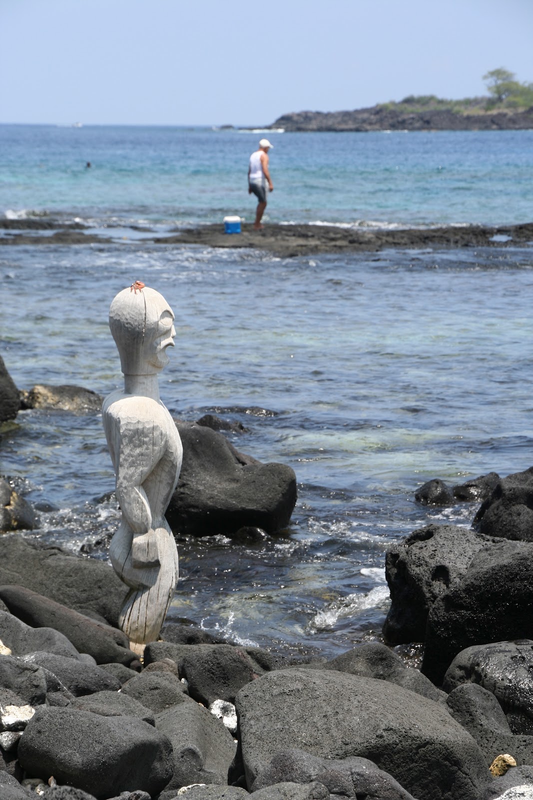
From the big island, Hawai'i, we flew via Honolulu to an older island, Kaua'i, which is quite simply one of my favorite places in the world.  I say older, because compared to the relatively new (from geological standpoint) island of Hawai'i, Kaua'i is several million years the senior, having formed when the Pacific plate was located further east of its current location.  At such a time, the full force of the deep-Earth hot spot was devoted to giving fiery birth to Kaua'i, in the form of near continual (again, from a geological standpoint) volcanic eruptions.  Anyway, long story short, after ~5.5 million years of natural forces having their way with it, the island is now an epitome of tropical paradise. 

In this post, I'll be circumnavigating the island, starting and finishing in the epic Na Pali Coast on the northwest side of the island and traveling in a counter-clockwise route.  The picture above is one of the most photographed viewpoints in Hawai'i (if not THE most photographed), looking down into the massive and stunning Kalalau Valley.  We were incredibly lucky to get such good weather too, as you'll find out below.


This viewpoint is literally the end of the road.  The main "highway" on Kaua'i doesn't quite make it around the entire thing, with the sheer cliffs, deep valleys, and high mountains of the Na Pali Coast causing the final barrier.  Fortunately, Hawai'i state management has set aside the Na Pali Coast as a state park, so it is fully protected from any development and left (mostly) alone to bask in its natural glory.  Kaua'i as a whole is an incredible example of the erosive forces of nature, but this is particularly clear along the Na Pali Coast.


There are waterfalls everywhere in Kaua'i.  The three in this picture are really quite large and high, but they are dwarfed by the far distance between us.  Waterfalls are what you'll get when you plop a swampland at the top of these crazy mountains.  So we can all thank the ancient volcano for leaving the caldera up there for water to settle into!  Anyway, this swamp is perpetually draining via the sheer cliffs and mountainsides all around, resulting in a lot of waterfalls, particularly when it rains, which happens a lot up in the swamp (see more on this below).  These falls are huge too.  Falls are found all over the island too, not just coming off of the highest places, and the immense forces of flowing water over time, paired with the volcanic soil/rock characteristics, are responsible for the deep valleys and heavily crenelated ridges found around the island. 
 

And here's another game of scale sizes... can you find the large helicopter in this picture?  Hint...its dead center, hiding as an ocean white cap.  The Kalalau Valley is huge...the scale is quite incomprehensible and really escapes you when looking at it all at once.  This helicopter was nice enough to fly around the valley for us though, exemplifying just how enormous the place is.


Just another view down into the valley...the pictures do little justice to how spectacular it is in person...


So, as I mentioned above, the Alaka'i Swamp gets a lot of rain, and we were very lucky to have such clear conditions.  Take a look at that elevation too; that means the ocean below in the previous pictures was vertically just short of 1 mile down.


The "hiking trail" leading off into the swamp.  It is really more of a wash now that it has been cleared of vegetation.  From my first trip, I know it is a mire of slick mud when it is raining...the swamp itself is huge, and there is a system of trails going through it.  Supposedly, it is a great place for birdwatching, with some rare indiginous species in unusual abundance.


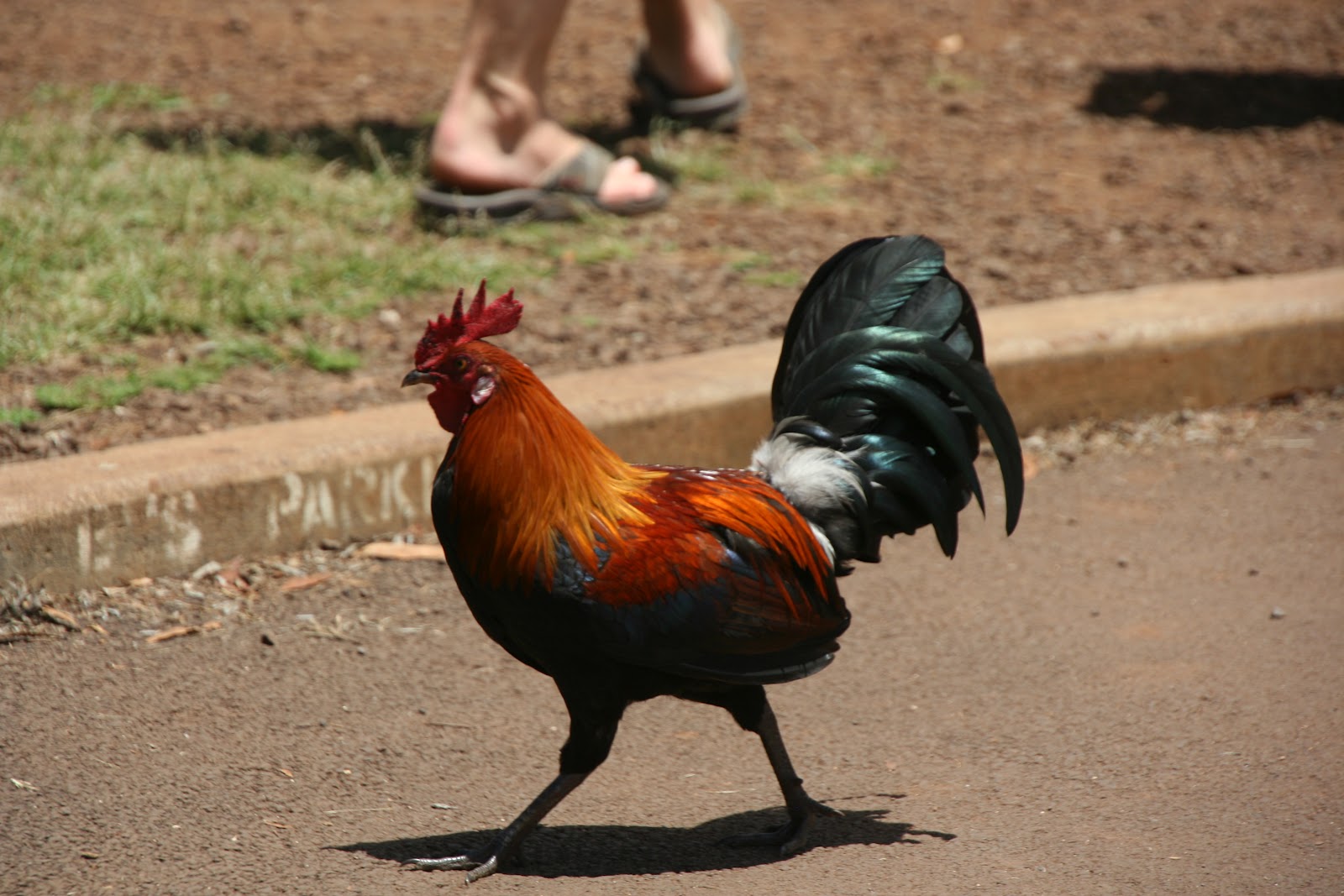
Speaking of birdwatching, here is a picture of Kaua'i's most populous species of bird (I have no idea if that is true or not...but it certainly seems that way).  There are wild chickens everywhere on Kaua'i.  They originally came with the Polynesian settlers, but unlike the other islands, there numbers in Kaua'i aren't kept in check by any "natural" predators.  You see, the Polynesians also brought mongooses with them across the Pacific, and on the other islands the wild mongoose population keeps the wild chickens in check by eating chicken eggs.  However, there are no mongooses on Kaua'i...the legend goes that one of the caged mongooses on the canoe to Kaua'i bit the canoe captain, who then threw the cage full of feisty, little critters overboard for the sharks.  Who knows if that is true, but for whatever reason, there are no mongooses and lots of chickens on Kaua'i.  I mean, we even saw roadkill chickens and a road-side wild cock-fight (honestly, this wasn't being staged...just two cocks fighting at the side of the road).  On the island, anyone can kill a chicken whenever they want...it is open season, no limits...so technically, you could eat chicken whenever you wanted for free.  However, plucking and cleaning (and killing) a chicken takes time and effort, and when you can get a full, plucked and clean, dead chicken in the store for only $5, why bother messing with the live ones?   


Enough about chickens...back to the scenic wonder that is Kaua'i.  Driving away from the end of the road at the Alaka'i Swamp and Kalalau Valley lookout, you enter the Waimea Canyon, what Mark Twain once referred to as "the Grand Canyon of the Pacific!"  It is pretty spectacular...there are several epic lookouts over a staggering, lush, and deceptively large, canyon landscape.  The thing I like most about it are the range of colors present in the various layers...both in the soil itself and in the vegetation, which changes drastically at different elevations through the canyon.
 

Once again, we were really lucky to have such incredible weather...this picture exemplifies the incredible contrasts provided by the colors in the rock and soil and by the shade of passing clouds.


Waimea is like the Grand Canyon in that distance loses all scale... the scene stacks up and you have absolutely no idea how many miles different features are away from you or how big they really are.  I also really appreciate how alive Waimea is... all the vegetation and those different shades of green add in to the palette of blue sky, white clouds, and grey, black, brown, and red rock and soil.  We speculated that the soil was so red on Kaua'i because it was older, and thus more oxidized than the very black, fresh lava rock of Hawai'i.


I've really run out of things to say about the canyon and these shots...but I just couldn't take these out...too much detail and color.


A view down at the river responsible for the epic canyon...it is hard to believe that this miles wide gouge in the earth was generated by this one ribbon of water.  It makes you wonder if perhaps Waimea Canyon formed due to some catastrophic release of water from the Alaka'i Swamp or some ancient lake in the old volcano's caldera.


Coming down out of the canyon to the south shore of the island.  The small town of Waimea is definitely worth a stop, both for the Waimea Brewing Company and some of the local food offereings...


We stopped at this Japanese grocery mart for some authentic poke (pronounced "po-kei" or "po-kay"), fresh raw seafood sliced up and served with some basic seasonings and vegetables.  Ingredients include octopus, squid, ahi tuna, and/or salmon mixed up with Maui onion, tomato, garlic, chile peppers, and/or seaweed and all covered with some combo of soy sauce, sesame oil, hot sauce, and/or sea salt.  Poke is a pretty standard appetizer in the islands, and man is it delicious!  My favorite was definitely the spicy ahi tuna, with Maui onion, and some kind of soy/mayo/sesame sauce with sesame seeds.  Incredible.

The Spouting Horn, a blow hole.  This certainly is a tourist trap, but it is in a lovely location, what with the black lava rock platform back-dropped by the deep blue Pacific, and the drive out to it passes through some gorgeous country-side with some incredibly big, old trees and pleasant farmland.  The larger blow hole in the center supposedly used to be much bigger (and actually active with vertical), but a farmer collapsed it with dynamite to keep the salt spray off his nearby crops.  The blow hole makes a pretty rhythmic breathing sound thanks to the motion of the surf and the air trapped in the passage down to the sea.  The native Hawaiians had a legend about a giant lizard that lived underground, which was responsible for the massive breaths.  Here goes the "Where's Waldo" game again...can you spot the photographer in the picture?  It makes you realize how large the plume of water actually gets...kind of impressive really.


Another waterfall...this one inland.  These are the Wailua Falls, just a short drive inland from Lihue, Kaua'i's biggest town.


We spent a day kayaking up the Wailua River, which flows radially out from the center of the island to the east coast.  The river flows gently, is quite wide, and clean.  This is definitely a highly recommended activity.


Up the river, we parked the canoes and went for a hike through the jungle.  We had a local guide, who informed us of all the edible and native or non-native plants.  The most interesting edible ones were the giant yellow flowers (good as a laxative) and the mushroom-flavored tiny purple ones (supposedly a mild hallucinogenic).  Another highlight was the natural "room" formed by legitimate walls of leafy vines.  The jungle itself was just gorgeous too... the island is so lush, with water and life everywhere.  And it is so tame as well, no dangerous animals other than wild boar, which are good about avoiding humans (rightfully so as they are hunted for food).  We did most of the hike in bare feet, enjoying the feel of mud oozing between our toes. 


The hike ended at this waterfall.  The water was crisp and cool, and the bottom was really rocky/treacherous.  It was deep towards the center, though, so we just ended up swimming.  This is where I got my first real appreciation for just how strong the wind coming off a waterfall is.  It was impressive how just this little fall pushed enough air out of its way to cause a stinging spray.  The force of the droplets and larger deluges hitting you on the head actually stung too... a truly amazing and enlightening experience. 


Swinging around to the north coast now, and Secret Beach...one of my favorite beaches in the world.  What makes it so special?  First, it is secluded...not at all a secret, as the name implies, but getting down to it does require an "off the beaten path" drive and a short hike through the bush, the combination of which apparently deters quite a few people.  Next, it is scenically very pleasant and really big.  There is a lighthouse and an island down at the far eastern point, and mostly unspoiled naturally vegetated hillside facing the shore.  There are also these awesome outcroppings of lava rock, and a small creek flowing out of the jungle and into the ocean.


The houses up there on the bluff are supposedly some pretty prime real estate...Julia Roberts even owns one near here.  I just love how the sand, rock, and water contrast...so beautiful.


Here is that creek I mentioned...just a nice little touch, you know?  It makes it great for washing off a surf board and rinsing off after a session too!


Back on the main road driving west along the north shore of Kaua'i.  Driving around the island is just epic... going from one jaw-dropping landscape to the next.  The road itself is really fun too, very windy with plenty of nice bends and curves.


Further west along the north shore is the Queen's Bath.  A system of tidal pools and channels, the Queen's Bath is this one seen here, which is pretty well sheltered from the surf (which batters the outlying rocks with terrifying force by the way).  It is deep too, deep enough to dive in and swim around.  It's quite nice, but...


The area immediately surrounding the bath is the really beautiful part.  The rocks just seem to plunge down into the water...you don't see the bottom or any slope really... just that incredible deep blue.


There was this spot though, where some local teens were showing off and jumping off the cliffs ~20-25 feet or so down into the water.  The swell in this little cove was incredible...there is actually a shelf about 8-10 feet down or so on the far, closed-off end of the cove, and it was exposed each time the water swept back out to sea, just to be covered back up again with the next inrush of the sea.  The water was powerful, but alluring... I mean just look at that color.  It was tempting to jump, but the locals definitely knew what they were doing.  They timed their jumps just perfectly, waiting for the water to start rushing back out of the cove, timing the fall so that they landed when the water was lowest (guaranteeing the furthest fall too).  They would swim into the middle for the next in rush, then swim towards the shelf, against the current while it flowed back out again.  On the next in rush, they would get over to the shelf and either scramble out directly from the high water, or let the water strand them on the shelf and hurry to scramble up the wall before the next inrush.  Pretty impressive overall....and pretty intimidating when thinking about doing the jump yourself!


We also had the pleasant surprise of four green turtles, who were just hanging out in the cove.  The jumpers were careful not to jump onto the turtles, who really didn't seem to notice the people very much.  They seemed to be having just as much fun in the undulating water as the people were!


The phenomenal backdrop to Hanalei Bay, with the water rushing down in falls thanks to the cloud dumping rain on the top of the mountain.


We got some surfing in on the small, odd knee-highs that would build-up out of the pretty calm bay.  The break may have been small, but it was well formed, consistently left breaking, and carried enough power to make it quite easy to catch.  It was a really relaxing session, and with that backdrop, I found it difficult to focus on looking out to sea for the next wave!


Looking back down on Hanalei and its bay.  It's scenes like this that just floor you... you are overwhelmed with this feeling of "this is too beautiful to be real...have I died?  Is this heaven?"  At least that's how I felt when I saw this and other landscapes like it around the island.


Rice paddies in yet another beautiful landscape scene.  A lot grows on the islands...a lot.  From what we could tell, food in the stores was relatively cheap (compared to LA at least) except for that imported from elsewhere.  They had a lot to offer though, the normal stuff like beef, chicken, and pork...as expected, phenomenal and super fresh seafood, plenty of rice, and tons of fruits and vegetables.


When I wasn't driving, I had my camera out the window a lot... it doesn't capture it though...the immersion of driving through a landscape is fully lost in photographs.


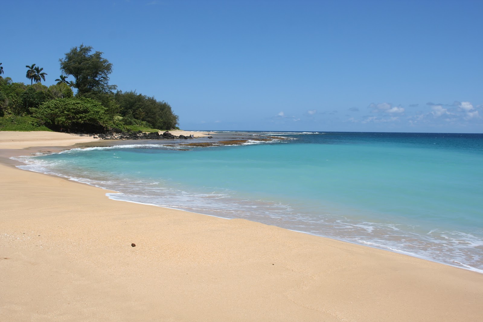
Tunnels Beach... another of my favorite beaches in the world.  This little gem is located near the end of the road on the western side of the north shore...right before entering Na Pali State Park.  I mean, what doesn't this beach have?  There are a few private houses, but overall, it is pretty lush wilderness along the beach front...no awful, massive hotels.  The water is crystal clear and brilliantly blue, and the sand is soft.  There is a coral reef practically right up to the beach, making for some awesome snorkeling.  There is a surf break off the point, and just look at these mountains!  What else can you ask for.


Then there is this little area, right at the bend in the shore, where a small creek pours out into the ocean.  I'm guessing that this is no coincidence...the water is literally chalky here, giving it this incredible translucent turquoise-blue color.  It is a cloud though...you can go from the snorkeling area over the reef, where the water is gin clear as they say, into this zone and go to basically zero visibility.  There is a pretty regular big beach break there too, which is a blast to jump into.  It's also pretty funny to see it wash up and knock unaware tourists right off their feet!


I just love this shoreline.  That shark fin mountain and those spires are just incredible....like catching a glimpse of some giant green sea serpent plunging back into the depths.


Finally, the end of the road: the famous Kalalau Trail.  This backpackers mecca winds, meanders, snakes, and climbs and falls its way along and around the cliffs of the Na Pali coast.
 

The first part of the trail climbs through the forest, then all of the sudden you turn a corner and are faced with this view.  The trail hugs the coast, winding in and out of the valleys and tempting fate along the edge of cliffs 100's of feet high, threatening falls straight down into that beautiful blue water below.


Here on the trail, we've come nearly full circle from the beginning, looking down into the Kalalau Valley.  People can get a permit and hike the full, 22-mile round-trip length of the Kalalau Trail all the way to the beach we were looking down on from the viewpoint, 1-mile above. 


Our first stop...the beach.  Officially Hanakapi'ai Beach, it is really known as just "the beach" to most day hikers.  This is the last place that the Kalalau Trail hits sea level until mile marker 10 (i.e., 10 miles in from the start of the trail), so it is the major destination for day hikers.  To get to it, the trail crosses a pleasant stream coming out of the deceptively deep Hanakapi'ai Valley.  The surf here is strong, and rough.  With the sweat you have surely built up from the hike in, it is awfully tempting to jump into that perfect blue water, but beware.  If you are not a strong, confident swimmer that is familiar with rip tides and ocean currents, I would recommend sticking to cooling off in the equally refreshing, and near-infinitely more tame, creek.  The beach is beautiful though, and it makes for a great resting point, where you can reload your calories with a nice picnic on the round smooth boulders, and wash off the stink of the trail or sea water in the wonderfully clean and clear creek.


If you aren't satisfied with just the hike to the beach, you can hike up the valley for another 2 miles to the Hanakapi'ai Falls.  The trail is muddy, very muddy, but it is a good hike, and you can even check out the ruins of an old coffee mill in the forest along the way.  The hike gives you a good feel for just how big the coast, cliffs, and valleys really are in Na Pali.  What looks to be so close from the beach is 2 miles away, and huge.  The falls are the origin of the creek, and the falls are very, very high.  I used the picture above specifically for the people standing in it for scale.  I should note that they are still a good 50 yards or so from the base of the falls, so we are still suffering from perspective making the people look bigger than they should!
 

As with all the falls on the island, I was transfixed by the finer details in this one...


The wind coming off of the bottom of these falls was intense, yet amazingly it was very calm in the cove on the other side of the waterfall.  The water was deep, rocky, and very cold too.


So there we go...a round-the-island, whirlwind tour of Kaua'i.  I only focused on the highlights of our trip (excluding the wedding out of respect for the bride and grooms privacy of course), but Kaua'i has so much more to offer.  The surfing was just right, with what we found to be beautifully consistent and powerful waves despite all the locals complaining about how dead it was.  I could spend a long time exploring all the different food options...primarily the ingredients and the local styles of preparation, most of which are very simple, but so delicious thanks to ideal flavor pairings.  The landscape is perfection... it is most definitely the type of place I want to escape to and immerse myself in and get to know intimately.  Kaua'i is known as the garden island, and I hope it stays that way. 

03 September 2012

Hawai'i


Commonly known as "the Big Island," Hawai'i is the namesake, largest, newest, and easternmost of the islands in the Hawaiian chain.  It is odd to some to think of an island as "newer" than others, but Hawai'i is one of the few spots on Earth where you can go to see new land being formed and an island rising up out of the sea floor.  We spent a few days exploring here before venturing over to Kaua'i for our friends' wedding.  It was my first trip to Hawai'i the island, but not the state, and it was very interesting to see such distinct differences from Kaua'i (where I'd been before in 2007), both in the landscape and the people and culture.


When referring to the places on the island, much of it can be described quickly as: "on the Kona side" or "on the Hilo side" after the islands two major population areas.  We actually flew into Hilo and out of Kona, but I'm going to present this blog in reverse.  So, the Kona side boasts one of the best preserved Hawaiian cultural sites in the islands: Pu'Uhonua O Honaunau National Historic Park.  This site was a "place of refuge" where native Hawaiians could be absolved of their crimes by a priest.  To do so, the law breaker (who had simply to break one of the ancient, sacred laws...like men and women not eating together for instance) could escape punishment by death by somehow making it onto Pu'Uhonua territory (Pu'Uhonua O Honaunau is just one of many such places) and awaiting absolution from the resident priest.  Interestingly, Pu'Uhonua O Honaunau (as well as most of the other Pu'Uhonuas...each island had at least one) was also the seat of great chieftains, who set up their community just outside of the Pu'Uhonua walls... makes you wonder how connected the chiefs were to the priests, and vice verse, and just how much control the chief and his men had over access into the Pu'Uhonua.  Access likely involved some gauntlet of guard dodging, whether approaching from land or by sea. 


Anyway, Pu'Uhonua O Honaunau has been restored and maintained by the U.S. National Parks Service.  The site is beautiful, with crystal clear, shallow waters, walls and platforms made of intricately stacked lava rocks, tall palms for shade, fish ponds, thatched buildings, and these incredible ki'i (Hawaiian for tiki, which is Maori for idol) statues.  These large, wooden statues of gods take shape in somewhat human form, and they just look incredible in the Pu'Uhonua surrounding, even if they are modern replicas.


If anyone is a fan of the TV show Lost, this should look remarkably familiar.  There were several of these stone game tables around the site, equipped with the small white and black stones used to play too!  My friend and I didn't know the official rules, so we ended up playing Go instead.


Looking across the royal canoe launch to the Pu'Uhonua.  According to the park information, the canoe launch was off limits to everyone but the King or chief, punishable by death (unless you made it to the Pu'Uhonua first!).  The wall of the Pu'Uhonua is seen amongst the palms here, and just to the right of it is a reconstructed great house, which would have housed an important, wealthy member of the community.  You can tell from the picture how clear and calm the water is here.  Submerged lava rock off shore acts as a natural wave break, and along with the shape of the coast here, it makes for a nice natural harbor.  Being there on a beautiful, Sunday morning, the place was just perfectly peaceful, beautiful, and relaxing.  I could have lingered there in the shade of the palms for hours.... definitely taking the odd dip in the ocean to cool off and swim.


Another ki'i, wearing a live crab for a hat with a local fisherman in the background.  We saw a few people reaping the fruit of the sea here, though I doubt the Kings of the past would have allowed common fisherman to work so close to their home though.


A pair of ki'i by the perfect water.  This combination of crystal clear, blue water, white sand beach, and black lava rocks is just beautiful.  Between that and the calm, quiet conditions, it gave the place an almost fantasy-like feel.  Heavenly could also be used to describe it...and without a doubt idyllic.


The group of tall ki'i by the largest hut and Pu'Uhonua.  These were big (12+ feet?)...and each one was different. 


Looking back at the big hut, tall ki'i, and Pu'Uhonua rock wall through the palm trees.  The gradient in the background is the main one on this side of the island...it just keeps climbing up and up like that til it hits the 8271 foot summit of Hualalai.


Any coffee aficionado knows that the Kona region of Hawai'i is one of the most famous in the world for growing coffee.  On the mainland, it seems sometimes like Kona coffee sells for about its weight in gold...it is prized, high demand with small, localized supply thanks to it only growing in one small part of one island.  I got hooked on Kona coffee on my first trip to Kauai, and I was really looking forward to going to Hawai'i and actually seeing the region and tasting the freshest Kona coffee.  For whatever reason, thanks to the local soil chemistry, Kona coffee tends to be very low acidity, with almost a naturally sweet hint to it...it is delicious coffee, well worth just drinking black for the complexity and richness of the flavor.  This picture was taken at the Coffee Shack, a small roadside breakfast/brunch joint off the main highway just south of the town of Captain Cook.  This place was really spectacular.  The food was phenomenal (I had eggs Benedict with fresh, pan fried fish...incredible combo!), and they serve Kona coffee WITH FREE REFILLS!  Amazing...I might have been slightly shaking by the time we left...definitely tweaked out on caffeine, but so worth it.  On top of all this, the Shack occupies a converted house with this view over the region down towards the coast...a spectacular setting to eat some good food and drink the world's finest coffee.
 

Back on the road, and welcome to Hawai'i.  Driving along the Kona side, you are often reminded of the potentially devastating nature of Hawai'i.  The highway cuts through the decimation swathes cut out from old lava flows from Mauna Loa, like the one pictured above.  It is pretty mind blowing to see.  The locals must have an interesting, come-what-may worldview, since the island may at any time just spill out a flow of destruction toward their homes.  You can tell approximately how old a lava field is by how much vegetation has started to grow on it.  Eventually, the landscape goes back to normal vegetation, until the next flow that is.  Hawai'i really is a big island...driving at ~55 miles per hour, it takes over 3 hours to drive from Kona to Hilo, half-circumnavigating the island (it takes over 2 hours if you just drive straight across through the center of the island).  The scenery is quite amazing too and changes drastically from one side of the island to the other.  On the Kona side, the landscape is quite dry, not desert like, but it obviously doesn't get a lot of rain.  On the Hilo side however, it is lush and while we were there, there were always water-logged clouds in the sky threatening rain showers.  This difference of course is thanks to the massive summits of Mauna Loa and Mauna Kea, which create a rain shadow on the Kona side, and seemingly rainforest conditions on the Hilo side.  Again, the slope of the landscape seen here in the picture, just keeps going like that up towards the center of the island.  This slope seems quite gentle, especially when considering that it takes the landscape from sea level to over 13,000 feet on the summits, which is really testament to the size of the island.


The source of the islands current growth, the Kilauea eruption.  As you can see from the picture, we didn't have the best weather for our visit to Volcanoes National Park, home to one of the most active volcanoes on the planet.  This is looking down into the Kilauea Iki Crater, the line through the middle of it is the hiking trail across it.  Along the length of this trail, the crater is more than a mile wide, and this is the smaller of the two big craters at the summit of Kilauea. 


The landscape lets you know it is alive and active... steam rises from fissures in the ground.  An incredible experience is to lay on the ground, or even just press your palms down to it, and feel the heat coming up through it. 


Inside the Thurston Lava Tube, a tunnel carved by lava.  Most interestingly, this one opens on either side to the forest, allowing visitors to walk through the entire thing!


Hiking across the floor of the Kilauea Iki Crater.  Look at the groups of people in the distance, both midway and out near the steam...this crater is huge.  We hiked across the crater longwise and up the far side wall, which allowed for an overlook down into the main caldera.  The much larger, Kilauea Caldera is normally accessible by car but was closed thanks to current levels of activity (more below).


Pu'u Pua'i, a cone of debris leftover from the 1918-1919 eruption.  This is a small mountain, and it is just mind blowing to think that it is the result of a fountain of lava bursting from the ground.  The lava fountain supposedly reached over 1600 feet into the air!  Truly unbelievable...I can't imagine a plume of liquid rock shooting skyward over a thousand feet and falling back to deposit a small mountain on the landscape.  It would seem like the end of the world, when really, it is just the world doing what it does.


The landscape in the crater floor is bubbled and cracked... in places it looks just like the ground was in mid-boil when it froze...which is actually kind of what happens!  In other places like the one shown above, massive cracks have formed.  It is an otherworldly landscape and very intimidating.  In some places, the rock itself is very bubbly (small bubbles within the rock itself, like typical lava rock, not like the big bulges in the landscape) and so sharp.  Spots like that just ripped into soles of shoes, and if you were to fall, it would surely shred skin in the most ragged, gruesome ways.


Looking back down into the Kilauea Iki Crater (notice the trail again through the middle) from the trail along the top of the crater rim.  In the distance you can see the plumes of gas rising up from the Halema'uma'u Crater in the main Kilauea Caldera.  The biggest plume was the reason why the Crater Rim Drive and Trail through the main caldera were closed.  Volcanic gas is poisonous and can be deadly!


Driving down the Chain of Craters Road.  This drives through lava flow after lava flow, some older (with more vegetation) and some seemingly brand new (which, after only a few decades, they really are on geological scales).  The road is quite nice...it can't be too old since sections need to be repaved every couple of decades or so.


Looking down over the brim to the coast.  The landscape takes this big, sudden plummet, not quite a cliff, but pretty close before leveling off into a coastal basin.  It would be absolutely incredible to see lava pouring over this and down into the sea!  That has happened many times before, as evidenced by the most recent scars of lava flow across the terrain, but there were none within reasonable distance for hiking while we were there.


It is truly bizarre to see such fluid patterns and forms in solid stone.  To know that this was once flowing just really stirs the mind.  You can tell how fast the lava "freezes" though; the top layer must nearly always be crusting over with the real motion going on underneath, away from the "cold" air.


Looking up from the coastal basin at the ridge.  You can see the trails of old flows that went over this edge, and the "basin" at the bottom is mostly lava field.  Technically it is all lava field, since this is how the island grew, and is still growing, out of the sea.


A sea arch at the cliffs along the coast.  Seeing lava flowing into the sea and forming new land is still on my bucket list of things to do before I die.  I guess I'll have to return to Hawai'i to give it another chance though, since we weren't able to see any while we were there (we were expecting a hike, but we managed to be there at a point where none of the active flows were entering the sea).  However, when they do, it is supposedly a very epic, explosive, and very dangerous scene.  When the lava hits the water, it freezes suddenly and simultaneously boils large amounts of sea water.  You can imagine how between the new rocks plummeting into the water, causing plenty of splash and spray and the lava continually pouring over the edge, you can get some pretty turbulent freezing/boiling scenarios.  Some of these scenarios can involve steam getting trapped within rock or lava and building up to extreme pressures, which can then cause sudden, large explosions.  There were several, half-car-sized boulders up by the road that were marked as having been thrown from the sea!  That is several hundred yards... so the explosive force must have been huge!  Basically, when viewing lava entering the sea, they intelligently recommend staying back pretty far.


This part was just amazing.  This is where a recent flow had swallowed the road...absolutely incredible scene clearly demonstrating how lava just creates a path of devastation and new terrain.


The lava really overtook the road.  You can get up and hike across it here, and the lava field just goes and goes.  It is challenging terrain to walk across as well, continually undulating and very treacherous (seriously, DON'T FALL DOWN).


You can see how the pavement actually melted ahead of the lava!


Looking down into the Kilauea Caldera at sunset and the glowing plume rising from the Halema'uma'u Crater.  This was just beautiful, I wish we could have seen a bit more down into the inner crater itself.  I made out a bit with my zoom, but just knowing there was a lake of lava in there that we couldn't see was such a tease.


The light coming off of this lava lake was amazing, and the glowing plume was visible from all around the park at night.


Further east along the southern coast is the black "sand" Kehena Beach.  I say "sand" since really the beach is made up of small lava rocks, which are quite smooth thanks to the continuous grinding action of the surf.  This beach is just absolutely beautiful, and very secluded, which is why it is popular with nudists (you have been warned!).  Unfortunately, we had the same overcast, rainy weather that we had the whole time we were on the eastern side of the island.... I would have loved to see this black beach contrasting with beautiful blue water and sky!  Oh well, hopefully on the next trip!


Looking back the other way from the beach... I wonder how much those houses up there go for and also if it is possible to insure them, which I seriously doubt it is!


Kehena Beach is backed by these sheer, black rock cliffs.  Hawaiians have such a beautiful place to call home, it is no wonder they are so proud and protective.  On Hawai'i, this is particularly apparent.  The locals are very proud of their heritage and it was here that I first noticed the Hawaiian sovereignty flag.  The Kanaka Maoli ("True People") flag is horizontally striped with yellow, green, and red, and a coat of arms lies in the middle.  Native Hawaiians fly this flag instead of the British inspired official state flag since the official one is too reminiscent of the colonial powers (British and American) that have controlled the islands for the past few hundred years.  Having statehood, it will probably take an act of god to result in Hawaiian self-governance, let alone independence, yet many natives in the Hawaiian Sovereignty Movement want exactly that.

The polished lava rocks along Kehena Beach.


 We visited Hilo farmer's market, for the few hours we were in town.  This was a great experience and truly showcased how just about everything seems to grow on this island very, very well!  Some of the fruits and vegetables we saw were just absolutely huge versions of the ones we are used to at home (like papayas, green beans, leaks, and green onions for example).  There were also a lot of exotic fruits and flowers, which are just kind of the norm there.   Of course, there was also plenty of coffee and macadamia nuts, two of the big cash crops on the island, and several vendors had combined those big two with chocolate...very good.  One of our favorites was a pepper vendor with hot sauces.  To draw us in the guy offered for us to do a shot of his ghost pepper sauce.  Ghost peppers sit at the top of the capsaicin level charts, making them the hottest in the world.  The sauce was delicious though...it burned, and burned deep.  I thought I might have given myself an ulcer for about 10 minutes after taking the shot, but the taste was soooo complex and tasty!  Like sweet fire with a thousand different shades of flavor.  Jams and jelly vendors were also well represented, with incredible variety for offer, well beyond what you would ever find in your typical grocery store on the mainland.  Mango, papaya, passion fruit, coconut and many more, particularly neat combinations, were all available.  Finally, there was an interesting array of Asian food sellers, with ready made snacks and treats available to eat on the spot or take with you for a picnic later.


Akaka Falls sits in one of the deep valleys just in from the coast north of Hilo.  The Hawaiian islands are littered with waterfalls, one the erosive forces responsible for so many of the amazing features in the landscape there.  Incredibly this waterfall (129 meters) is over 2.5 times the height of Niagara Falls (51 meters)!  Being familiar with Niagara, this fact just rocked my world...the viewpoint doesn't do these falls justice.  Viewing it from around the same height and across the way, with no clear view straight down, robs one of the opportunity to get a good feel for the height of the falls.  As much as I tried, I just couldn't stack two and a half Niagara's up against Akaka in my mind's eye; no matter what, Niagara always dwarfed it.  Despite the immense difference in actual flow rate over the waterfall (Niagara quite literally dwarfs Akaka in that arena), Akaka is a much higher waterfall, which I think is a pretty neat fact.  It is in quite a beautiful and secluded setting too.  The flora on the east side of the island is dense and lush; everything is bright green and quite jungle like.


The falls were amazing, but the true beauty was in the finer details...the way the cascade shattered a thousand times during its fall due to air resistance or the way the immense amount of water in the tumbling packets blasted the air away in circular disc shaped jets from the base of the fall or the many smaller streams of falling down alongside the main cascade.  I don't know anyone who enjoys physics that couldn't just be captivated by such a beautiful and revealing natural show.  Watching the jets of water and air shooting away from the base of the falls was incredible too.  It was on this trip that I really developed a sense of the wind that develops at the base of a water fall, as the air is continuously pushed out of place by the downpour of water. 

 
We were up early our first morning in Hilo for the drive up to Mauna Kea for sunrise.  Mauna Kea is about half way across the northern end of the island and the biggest of its three high summits.  Mauna Kea peaks out at an astonishing 13,796 feet above sea level...which is just incredible considering that it rises right up out of the sea.  Technically, in terms of base to summit, this mountain is the tallest in the world, rising up ~33,000 feet from its true base on the sea floor; that is far greater than Everest, which only rises ~10,000 feet out of its base plane!  Mauna Kea is so high that it gets a seasonal snow cap on the summit, allowing people to snowboard or ski in Hawai'i. 


We greeted the sun rising over a sea of clouds, out of which we had just driven.


Looking across to the summit of Mauna Loa, rising up out of the clouds like an island out of the sea.  Funny enough, both summits are part of the same actual island in the sea.  Evidence of Mauna Kea's volcanic origins are also seen here in the form of the crater glowing in the morning sun.  Driving up to the summit, we passed through the many different climate zones, each quite distinct from the last.  In Hilo, we stared in lush, lowland terrain, then moved up into the large montane forest region.  This passed into sparse, subalpine woodland before the trees disappeared and we entered alpine shrubland, where the largest vegetation was just scrubby bushes.  Eventually, even these gave way to the empty, cold alpine desert of rocks at the summit.


Mauna Kea is home to a collection of international space telescopes.  Astronomers take advantage of the combination of high altitude and extreme remoteness, afforded by being on a sparsely populated island in the middle of the Pacific Ocean, to get data out of some of the clearest skies in the world.


Hawai'i is an absolutely beautiful island characterized by ongoing change and extremes of all kinds.  I look forward to returning.