
 Entering Fiordland National Park...
So here are the pics I promised...they are a lot because I had so much time to cover and I have also been very busy in the last week. I hope you enjoy them as this post has taken quite some time (and money)...voila.
 You can't really read it, but those crafty Kiwis wrote the sign in the middle of the lake in mirror so that it reads correctly in the reflection in the water...it reads: Mirror Lakes. This was one of our many stops throughout Fiordland National Park.
 No, that tree is not upside-down...and no the mountain is not (technically) either. That is actually the reflection of a mountain in one of the mirror lakes...cool stuff.
 Lets all thank the last ice age and its receding glaciers for carving out these amazing valleys and peaks that make up Fiordland National Park...THANK YOU ICE AGE GLACIERS!
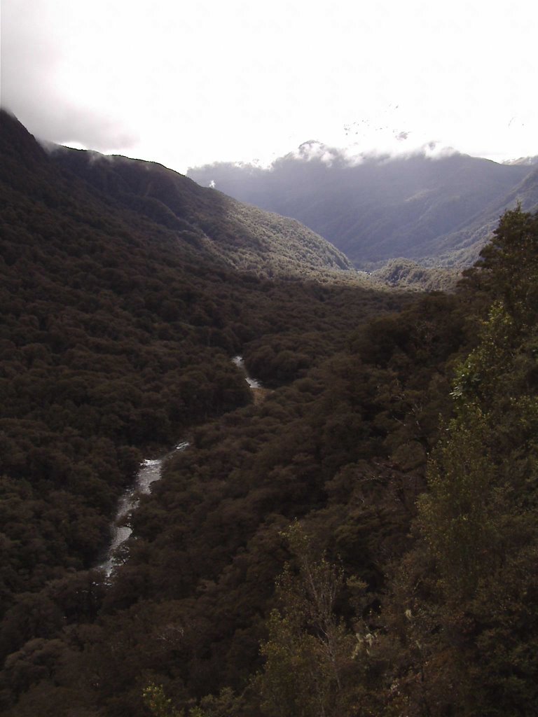 A lush river valley.
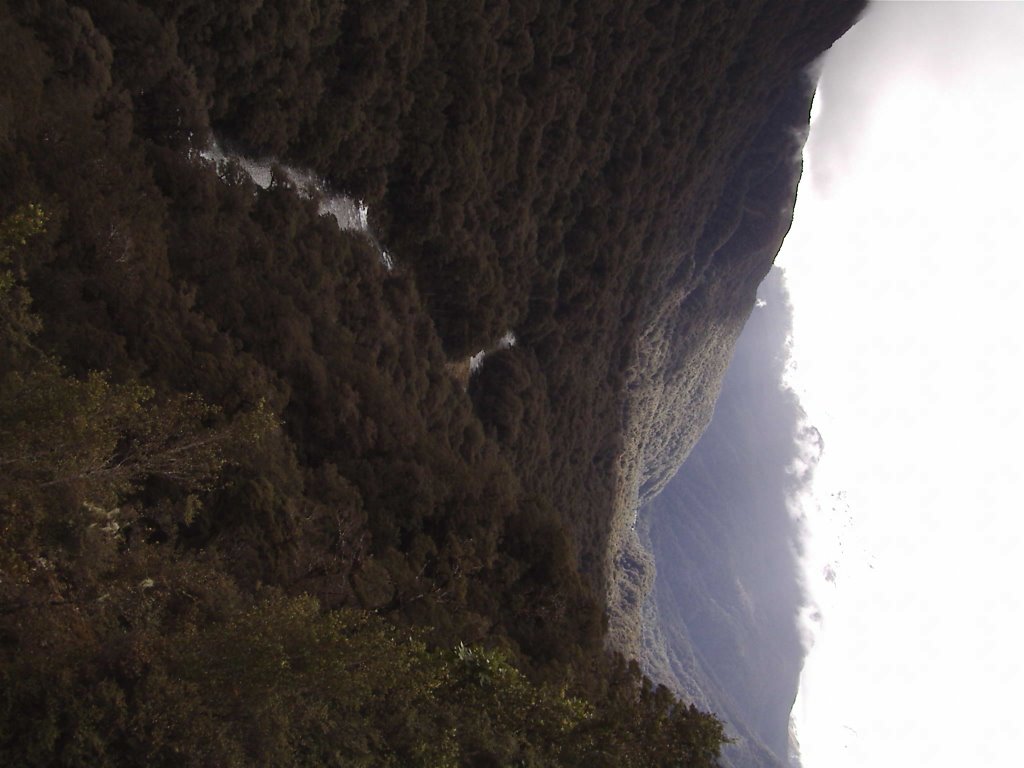
 See...waterfalls down sheer cliff faces...is that what you all pictured from my description?
It's hard to show that these are thousands of feet high though.
 yet another waterfall
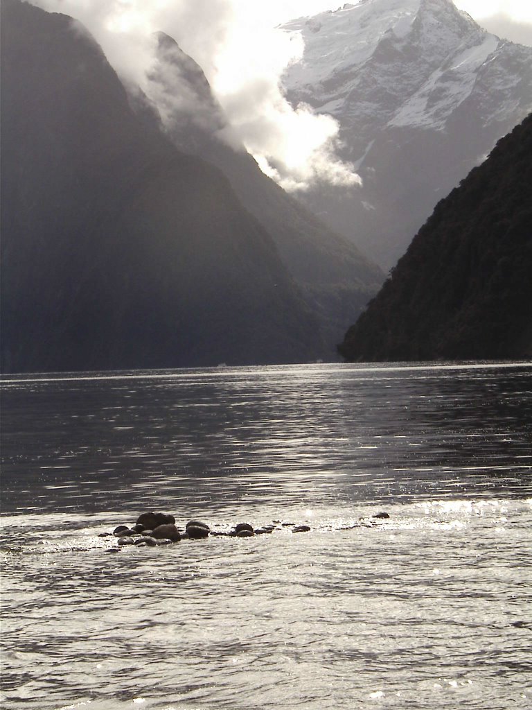 Ok, this one might take a magnifying glass...but the small white specs against the far off peaks (near center of pic) are actually huge ferries capable of carrying hundreds of passengers...trying to give a sense of scale here. This place is huge.
 Whoa...who's that?? I snapped this so that you can all see I am alive and don't have a massive shaggy beard or anything.
 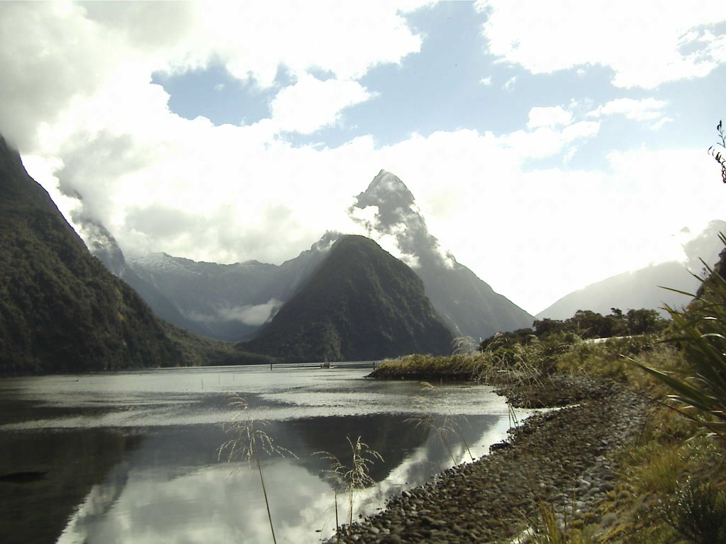 Milford Sound (actually a fiord)....and this is just a picture.
I can't immagine a more grand and majestic place.
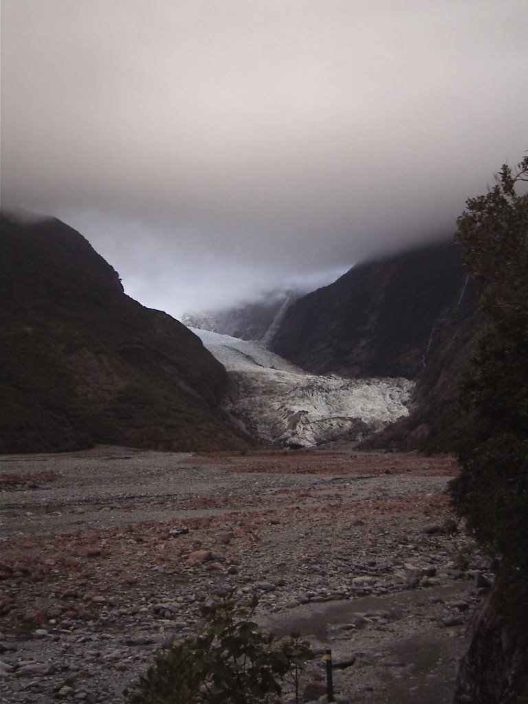 The Franz Josef glacier. I wish the bright icy blue of the top would have turned out...oh well.
 The Franz Josef glacier. Notice the two small dots amongst the rubble in the mid-bottom-left part of the picture...they are people walking up to the face. I took this pic just under 2 kilometers (1.2 miles) from the face of the glacier...yea the thing is huge. The coolest part is that it is surrounded by rainforested hills.
 One of the many one-laned bridges we crossed (they have a ton of these in NZ)...this one was picture worthy however because both lanes of traffic also had to share the bridge with the trains...and there was no gate at either entrance....pretty unique and unusual I believe.
 One of the bus stops had this lovely walk to some amazing rock formations...the Punakaiki Pancake rocks...cool eh?!?
 This is the walkway to the Barn, the hostel I stayed at in Marahau (at the top of the South Island), a one minute walk to the entrance to Abel Tasman National Park and one of the highlights of my NZ trip. The pics are a bit out of order, but they turned out well and you should get the idea.
 Yes, that is a tractor in the water. It is coming out with a trailor to pick up the water taxi. The water was only about a meter deep here and the taxi could go no further. The crafty locals therefore employ the tractors. The Tasman Bay experiences the most extreme tides in NZ. They can be up to 4 meters difference between high and low tide, that is more than 12 feet!!! So massive patches of beach and sand are revealed and then resubmurged based on the tide.
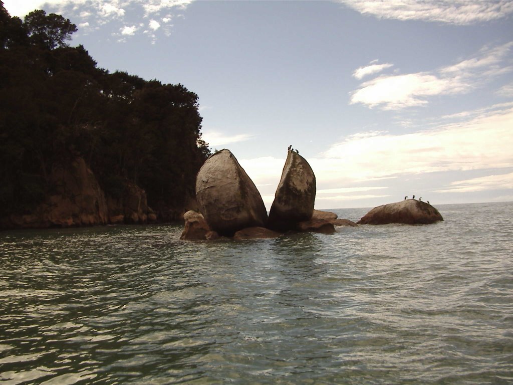 A local landmark, Split Apple Rock.
 Kayakers in the Bay. For quite some money (more than I could afford), one can rent a kayak for the day and get taxied out to one of the many islands that colonies of seals call home. The seal pups are very playful and often times actually jump up onto kayaks. It is supposedly an amazing experience...one that I will have to do when I return.
 Part of the beach at Bark Bay...this is where I got dropped off by the water taxi for my hike. I cannot possibly capture the beauty of this beach. The sands of Abel Tasman are a golden color from small bits of rust in the sand. That, combined with the perfect aquamarine blue of Tasman Bay and the bright vibrant greens of the forested hills, make this place so amazingly beautiful.
 Bark Bay campground...right between the beach and the lagoon...and one of my new favorite places in the world. I can't wait to come back here with more time and spend 3-5 days just camping and hiking this amazing park.
 The Falls River mouth.
 One of the lagoons as seen from the coastal track hike.
I believe this one was Frenchman Bay...lucky Frenchman, I'd say.
 One of the many beaches and tidal lagoons in Abel Tasman. This was Torrent Bay and it is one of the few places in the park where there are still houses from when people started developing the place before it got National Park status. So some very lucky people get vacation homes in this amazing park...but it comes with a NZ$4,000,000 minimum price tag...I'm still jealous.
  The valley before entering into the Abel Tasman Park...my hostel, the Barn, was back in that, surrounded by farmland...nice. It was a lot like Club Masa in Fiji...a place I could easily just lose myself at for weeks and months in the timeless beauty and laid-backedness of the place.
 The rocky beaches of Kaikoura...another of my favorite NZ spots...there are mountains, beautiful blue ocean filled with wildlife (nearby are whales, dolphins, and seal colonies), and the best fish I have ever tasted.
1 comment:
Drew, as always, the pictures are stunning.
Post a Comment