Me (in the black), my boss: Dr. Azeem (red), and our two science techs: Neal (in USA) and Bob (with blue hat). This was us just after the 2 kilometer race around that world that absolutely decimated our lungs. Neal and Bob will be "wintering over" staying the six months during winter in which no flights go in or come out of the continent. Wintering at South Pole Station is the one of the closest things on Earth you can get to space travel.
 Some race participants; yes that is a dude on a snowboard being dragged behind a snow mobile....why didnt I think of that?!?!? On the sled ahead of that is our version of Santa Clause. The race around the world just has everyone running, driving, being pulled, walking, crawling or whatever else around the pole in a large 2 km loop. It is cold and the air is super thin...it is hard as hell to run it, but the record time was 9 min 12 sec...sick. My lungs tasted like blood after about a quarter of the first lap, and I'm just happy that I made it considering it was only a day and a half after exposure to the altitude!
 This guy didnt seem too interested in running.
This is a nice shot of the station from the neutrino detection experiment called IceCube. You can see the new station, the old dome, the shacks and whatnot on the right, and our man-made snow pile as the only land feature other than flat, white snow.
 These vehicles were used by the men in red to traverse from McMurdo to South Pole. This might not sound too impressive, but when you take into account the crevaces in the ice practically the entire way that can be large enough to swallow one of those Cat's into a 1000 foot deep gash in the ice. Then there is the fierce winds that can blow up to 150 mph, the extreme cold that can cause frost bite in less than 2 minutes, and the lonliness of being almost totally out of touch with the rest of the world while you travel in a massive tracked vehicle, which can easily get stuck or have moving parts freeze, accross a baren wasteland of ice and snow. It's impresive; and just one more thing...think about going to the bathroom....yea...these people are tough.
 Here is a pic of the dome and one of the exposed tunnels that has been dug out from the accumulated snow. Note the size of the two guys up on the transition between the side tunnel and the main tunnel into the dome. Close to fourty feet of snow is piled up there, and it is being slowly cleared away.
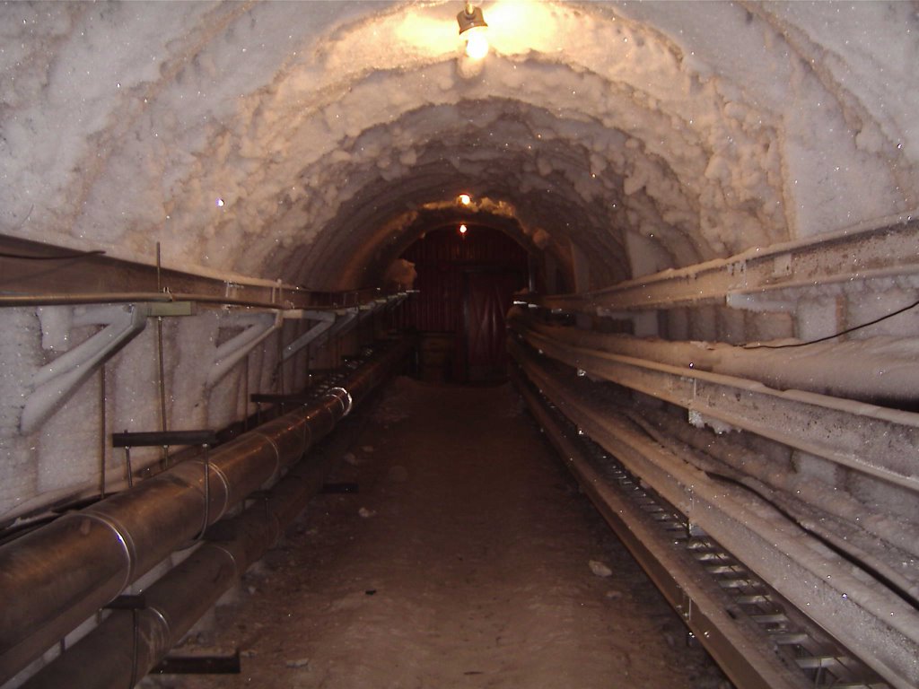 This is one of the many frozen tunnels that runs between buildings underneath the surface of the snow...I just thought it was really cool and it reminded me a lot of Hoth from the Empire Strikes Back!
 This is the hole being "drilled" for the IceCube project to study the existence of neutrinos, a practically indetectable, subatomic particle. They use hot water to melt the ice and snow ahead of the drill. They actually drill down like this through 2.6 kilometers of ice (like 1.5 miles!!!). This is the largest project currently at the pole. I'm pretty sure they are planning on drilling 60 holes, and it is amazing to see the project underway. They have massive, heated tanks for the water, a huge system of pipes that takes the water to clean it and heat it up, and even their own generators for power (since, when drilling, they use more than the rest of the station combined!). Sweet stuff.
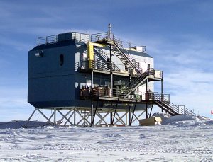 This is the Atmospheric Research Observatory (ARO): the building I work in. It is a lovely quarter mile walk from the station that we make at least two round trips of each and every day!
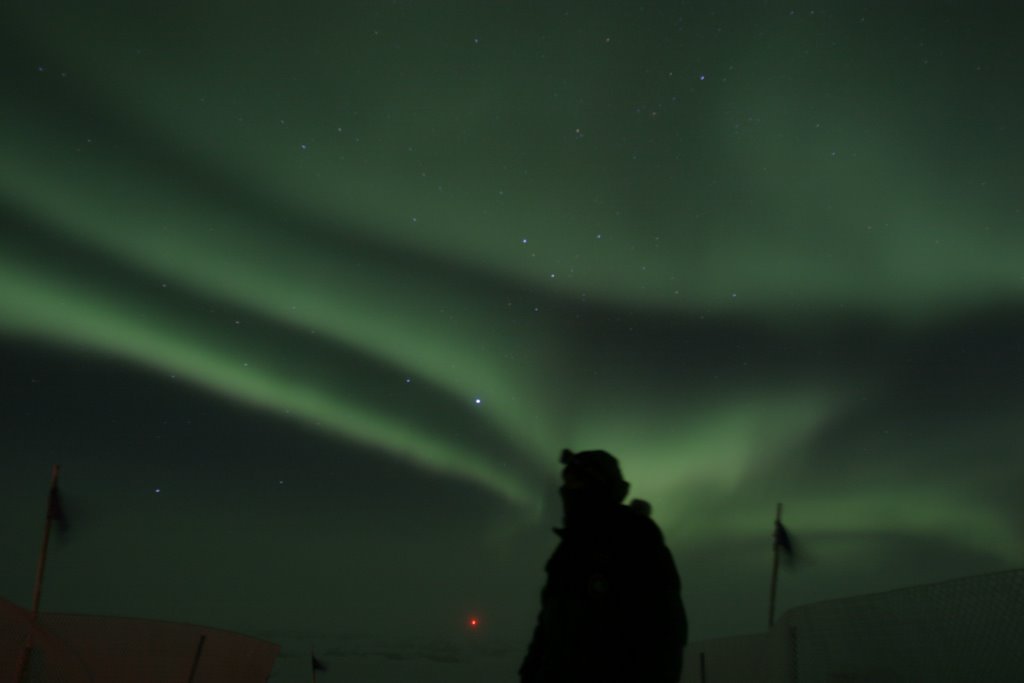 I did not take this picture, but this is a lovely shot of what I am down here to study: the Aurora Australialis. If anyone wants to know about the auroras, just let me know because I know way too much about them to explain it all on here.
  Here are Dr. Azeem and myself taking our "hero shots": pictures of us outside at the pole with our top layers of clothes off. Let it be known that when this picture was taken, it was a particularly cold and windy day and the temperature was a whopping -40 deg C (which happens to be -40 deg F as well). In other words, cold as the ninth layer of Hell.